GIS-based global inventory of managed aquifer recharge schemes with over 1,200 case studies collected from more than 50 countries worldwide.
About the portal
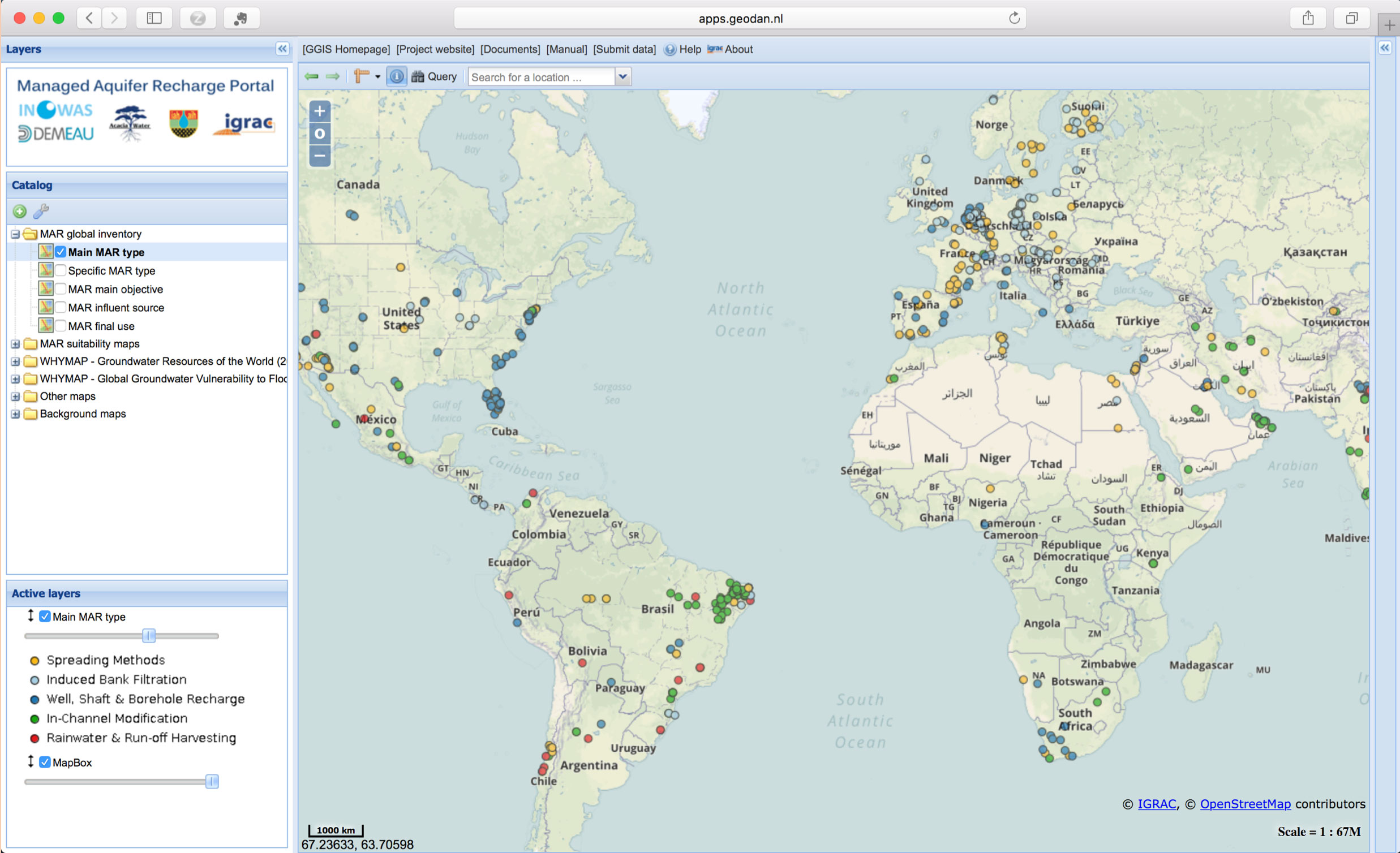
The first global inventory of managed aquifer recharge (MAR) applications was compiled by the Research Group INOWAS based on a comprehensive survey that covered around 60 countries. In total, general information about the site, operational parameters, local hydrogeological characteristics and water quality parameters were collected from about 1,200 MAR case studies. To provide easy access to the inventory and increase its availability to a wider audience, the data was shared with the International Groundwater Resources Assessment Centre (IGRAC) who developed a dedicated web-based portal for the MAR inventory. By facilitating access and promoting international sharing of information and knowledge on MAR, the web-based portal aims to increase awareness of MAR as a viable solution for sustainable groundwater resources development and management, and to provide a new tool for better planning of MAR applications.
The MAR portal is available online at http://marportal.un-igrac.org/ and can be accessed from any modern computer browser without the prerequisites of any GIS knowledge or software licenses.
How it works
The MAR portal consists of a data layer catalogue, a map viewer to visualize the selected data on a geographic location and a features panel to provide tabular output of the selected data. Additional information for each (point) location, such as references, can be displayed in the feature info. The portal can be used to generate new pieces of information by creating overlays of map layers (MAR suitability maps, or other overlays such as climate zones, population density, global groundwater stress, etc.) and to build queries on the data. For each case study, the following parameters can be visualized: site name, country, location, MAR type, year of scheme deployment, source of infiltration water, final use of abstracted water, as well as the main objectives of the project. Users can visualize this data by making use of the web services provided or can export the entire database in tabular format via download functionalities of the system. In addition to MAR case studies, the portal contains also existing regional MAR site suitability maps that were collected and made available online to improve accessibility to this information and provide guidance for MAR suitability.
Check the user manual for detailed instructions about the main features of the portal.
How to contribute
Do you know of a MAR project that is not yet included in the portal? We kindly invite you to provide to new data via the comfortable online submission form (data will be reviewed before including it into the portal).
References
- Stefan, C. and Ansems, N. (2017) Web-based global inventory of managed aquifer recharge applications. Sustain. Water Resour. Manag. https://doi.org/10.1007/s40899-017-0212-6